

What bike improvements are planned in your neighborhood? Which projects are actually moving forward? Where are the biggest gaps in Marin’s bike network — and what would it take to create a network that works for everyone?
Until now, there hasn’t been one place where you could see all of that. So MCBC built one.
One of our most important jobs at MCBC is tracking the many bike projects in the development pipeline. In order to see high-quality bike infrastructure delivered for Marin’s riders, we need to have eyes on projects at every step of the way, helping set priorities, shape the design, and sometimes carrying them across the finish line.
But we don’t want to keep all of that information for ourselves – we want our members and supporters to know the status of the projects they care about most. That’s why we have launched the MCBC Countywide Project Tracker.
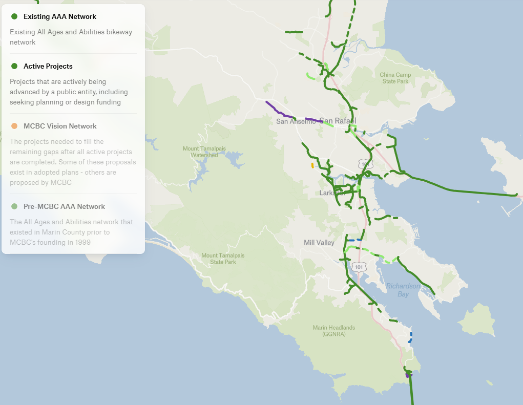
This interactive, easy-to-use map is intended to show four things:
- Marin’s existing All Ages and Abilities (AAA) bike network. What are the streets that make up the critical bike routes that someone would ride with an 8-year-old or an 80-year-old? (depicted in solid lines)
- The county’s active projects. These are the ones that are currently being advanced by a city, town, or agency, not just plans sitting on a shelf. At present, there are more than 20 projects moving forward across the county, ranging from seeking funding to nearly finishing construction. (depicted in dashed lines)
- MCBC 2050 Vision Network. We cover this more fully here, but these are the projects we believe need to be built to complete the county’s bike network for all of its users. (depicted in orange dotted lines)
- What was available to riders of All Ages and Abilities prior to the founding of MCBC in 1999?
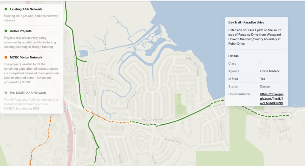
This post will focus on #2 above, the active project layer. Let’s use one project as an example. Here is Corte Madera’s Paradise Drive Bay Trail project between Westward and the Corte Madera town limits. By clicking on the project (which is a dashed line, showing it is “in progress”), the user can see a short description of the project, the status, a link to the latest designs shown to the public, the cost, the funding sources, the official website, and contact information for the implementing agency.
Check out our other post on the MCBC 2050 Vision Network to learn more about what we think would make the county’s bike network complete.
Here is the project tracker, which you can make fullscreen by clicking the button in the upper right hand corner.