News Updates on the Mill Valley-Sausalito Pathway and Bothin Marsh
A lot has been happening recently on the Mill Valley-Sausalito Pathway. This post is going to provide an update on the recent resurfacing work (i.e. smoothing out the pathway) and on the longer-term plan to realign the pathway to adjust to sea level rise.
October Resurfacing
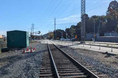
In mid-October, between rain storms, Marin County Parks resurfaced the Mill Valley-Sausalito Pathway between Gate 6 Road and Almonte Boulevard. As any frequent rider could tell you, the pathway was in very bad shape.
This was a badly needed project, however, when the plan was initially brought to us at MCBC, we were surprised to learn that no accommodations had been proposed for shuttling riders and walkers around the construction zone for the 1-2 days when the pathway was closed, despite there being no alternative route (US-101 being the only road between Sausalito/Marin City and Mill Valley). We did not believe that construction signage and the existing infrequent transit service would be enough for the many hundreds of pathway users, and would result in people being stranded.
Due to our urging, the County agreed to run an ADA van and bike shuttle to ferry people over the gap. As we predicted, despite all of the work the County and MCBC did to alert people about the construction, over 150 riders and their bikes needed transportation on the shuttle (including a group of flight attendants from Dubai, a bike rider from Arizona on a vacation to explore Marin’s bikeways, and a couple circumnavigating the Bay Trail). All of these people would have been left to fend for themselves without the shuttle service we pushed for. Going forward, we plan to use this example to ensure that adequate bike/pedestrian accommodations are provided during construction projects.
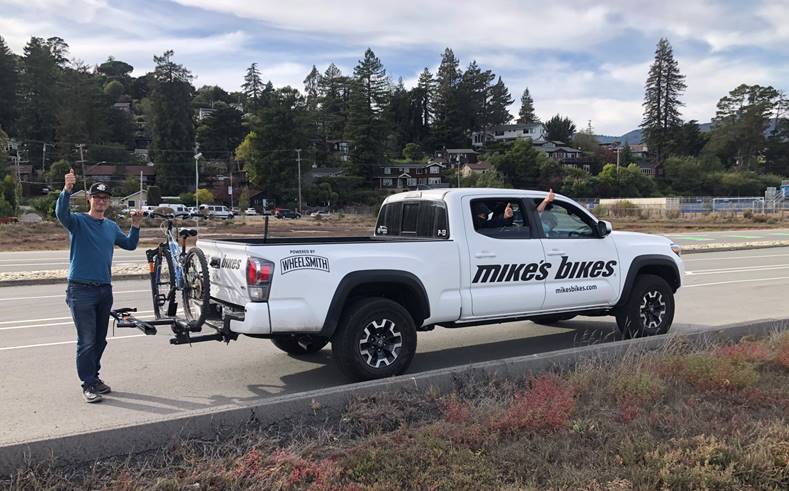
And now we all get to enjoy the newly-smoothed MV-S Pathway! Get out there and ride it!
Bothin Marsh Sea Level Adaptation Project
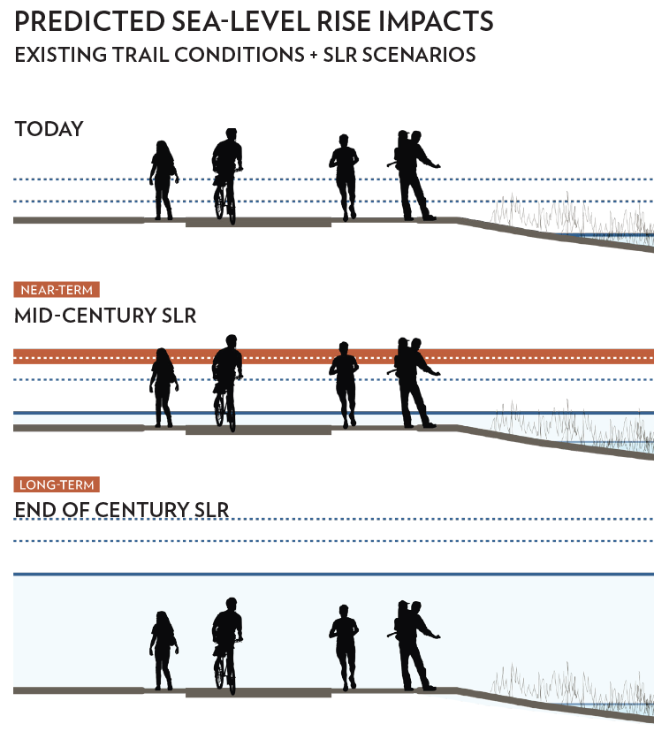
Sitting off Richardson Bay between Marin City and Mill Valley, the Bothin Marsh is one of the treasures of Marin. However, like many parts of Marin County and the wider Bay Area, it is one threatened by sea level rise. Under current conditions, the marsh floods 30 times a year, a number that is projected to rise significantly in the decades to come.
To ensure that the Marsh remains a place where the people of Marin can enjoy open space, connection with the natural environment, and emissions-free transportation, the Evolving Shorelines project was initiated in 2018 to evaluate the several possible futures for the Marsh. The project has been led by One Tam, a partnership of the National Park Service, California State Parks, The Marin Municipal Water District, Marin County Parks and Golden Gate National Parks Conservancy.
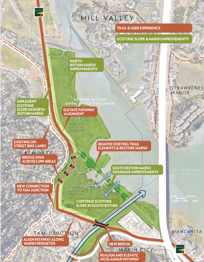
After many months of outreach and study, the project team selected the “Ring the Marsh” option as the preferred alternative. This would realign the Mill Valley-Sausalito pathway away from the former railroad trestle it uses today to instead pass behind the buildings on the east side of Tam Junction and hug Almonte Boulevard to the existing junction with the pathway.
While this alternative has some drawbacks, it also marks an improvement in other ways. The section below will explain our position on the Ring the Marsh alternative, and why we’re supporting One Tam’s decision.
Drawbacks
The first and most obvious change to the pathway would be its length, an important consideration for commuters or other travelers passing through the Bothin Marsh. However, while noticeable, the additional distance is not extreme. The segment between Coyote Creek and Tam High would be approximately 1,050’ longer, or about 50 seconds traveling at 15 mph.
The realigned pathway would not pass directly through the marsh as it currently does, which will no doubt have an effect on bird watching and the feeling of being ‘in nature’ while riding along the path, some of its best qualities.
Advantages
First and foremost, the pathway needs to be raised to address impending sea level rise. This could be done in several ways (such as raising the trail or building a bridge/causeway over the trail), but the Ring the Marsh alternative has the least ecological impact on the marsh itself.
Of the three proposed alignments, Ring the Marsh was the one most favored by survey respondents, as many people preferred the one with the least impact on the marsh.

The new alignment will provide much better access to the shops and restaurants in Tam Junction, previously only accessible by a bumpy broadway (the McGlashen Trail) and a narrow bridge. This project would add another access point at the intersection of Route 1 and Almonte Boulevard (near Hook Fish), bringing more people to the business corridor there.
This also means that multimodal access would be improved for anyone traveling between Tam Valley and Mill Valley, particularly for Tamalpais High School students. Rather than having to ride on the paint-only bike lanes on Almonte Boulevard, or backtrack to the McGlashen Trail, they can ride parallel to Almonte on the realigned Mill Valley-Sausalito Pathway.
Next Steps
At this point, the preliminary designs will be advanced while coordinating with the various regulatory agencies. We’ll be keeping you in the loop as things move forward and we will alert you to opportunities to give additional feedback.
If you’re interested in digging into the full report of the Bothin Marsh Adaptation Concepts, you can find it here.
(Note: an earlier version of this piece misstated the additional distance of the “Ring the Marsh” concept. This alternative would add 1,050′ additional end-to-end distance, not 1,600′.)
sign-up for advocacy alerts
We will need your help winning these improvements! Please sign-up for advocacy alerts using the form below and we’ll tell you when/how to support our efforts.
members make it happen!
We’re fighting for a more bike-friendly future in Marin. Are you with us? Join Marin County Bicycle Coalition today.