Marin County Open Space Bob Middagh Trail
STATUS: Open to Bikes
Bob Middagh Change-In-Use Provides Safety and Connectivity for All Open Space visitors
Providing safe connectivity is one of the MCBC Off-Road core mission objectives. The Marin County Open Space recommendation to allow bikes on the Bob Middagh Trail advances that goal.
Open Space’s thorough evaluation process involved outside consultants and more than 12 months of study. MCBC evaluates change-in-use requests carefully, with a thoughtful and considered approach. We understand new uses on an existing trail is a balancing act and have established a list of criteria to help inform us. As we consider any trail proposal, we focus on the benefits of connectivity, potential displacement of visitors, conflict reduction and environmental impacts. We also consider what need is being met by each proposal and what actions will result in the best possible outcome for all trail users.
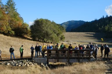
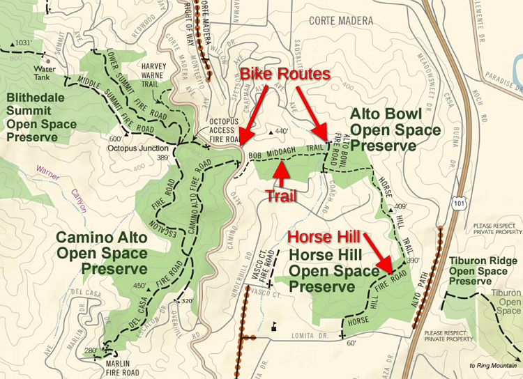
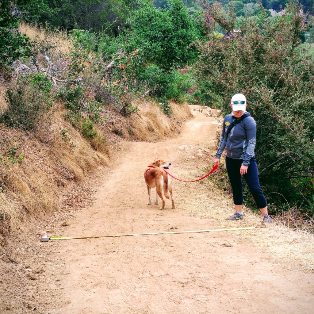
Bob Middagh Trail was originally built as a service road to construct and maintain a pipeline that runs underneath the trail. While growth has narrowed the roadway over the years, it still has a width of 5 to 8 feet, which provides ample room for visitors to safely pass each other. Bob Middagh Trail is short, has superb sight-lines and connects two popular bike routes, Camino Alto Road and Alto Bowl Fire Road.
A group of Mill Valley residents approached MCBC about the need for safer access between their neighborhoods and the many Open Space Preserves in the area (Alto Bowl, Camino Alto and Blithedale Ridge). Well east and north of the Horse Hill Open Space Preserve, the Bob Middagh Trail seemed to be the answer for a route separated from traffic which would provide this.
Bob Middagh Trail is an obvious candidate for a multi-use connector. Here’s why:
- It has broad support from the Mill Valley and Corte Madera communities – as illustrated by the fact that over 300 of the approximately 400 individuals who submitted comment letters to Open Space were in favor of the project.
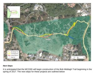
- It bridges a 2,000 ft (.4 mile) gap between two bike facilities, Camino Alto Road and the Alto Bowl Fire Road.
- It connects five Mill Valley and Corte Madera neighborhoods (Scott Valley, Alto/Horse Hill, Meadowsweet, Chapman Park and Enchanted Knolls) with three Open Space Preserves and Mt. Tamalpais.
- It is short and leads to no good bike trails, so it is unlikely to be used by people from outside of the neighborhood.
- It has a width of 5’ or larger, typical for a multi-use trail
- Most of the alignment has sight lines of 50 to 100 ft.
- It is a mostly flat and only has four turns.
The only steep section will be rerouted with switchbacks to ease the grade – making it easier to climb as well as slowing bikes down.
MCBC will work with Parks and other stakeholder groups to develop an outreach effort to assure a safe and successful transition to multi-use.
Construction began in July, 2017 and was completed in the fall 2017. It is a best management practice to keep bikes and horses off newly constructed trails through their first winter. The trail was scheduled to be open to bikes and horses in the spring of 2018. A lawsuit has delayed that action. We are following the situation closely and will provide details as soon as they are available.
Background: The RTMP (Road and Trail Management Plan
Following the adoption of the Road and Trail Management Plan (RTMP) in December 2014, MCBC began a series of workshops to learn what improvements bicyclists would like to see in each community. The first two workshops were held in Mill Valley and Corte Madera, with a focus on the six preserves that stretch between the two towns. While there were many suggestions, one action rose to the top – open Bob Middagh Trail to bikes.
It was somewhat surprising, given that it’s a short, nondescript trail that doesn’t really lead to any riding areas. But deeper review of comments shed light on the fact that it would close a significant trail gap between 5 nearby neighborhoods and Mt. Tamalapais. The proposal was essentially crowdsourced. Following these initial findings, even more residents contacted MCBC, requesting our help to move the change-in-use forward. In the summer of 2015 MCBC submitted this first trail proposal to Marin County Open Space District.
Since that time Open Space has scored the proposal and hired a consultant to look at all options. In August of 2016 Open Space held a meeting in Mill Valley to announce that staff had recommended moving forward with the change-in-use. In this meeting, they accepted public comments on that decision along with extensive feedback on three options for the change-in-use action, from opening the trail as is (Option 1), to rerouting sections of trail and adding switchbacks (Option 3). All options included improvements to three wet crossings, which will enhance a seasonal wetland at the East end of the trail.
Comment Letter
BobMiddaghCommentLetter9-21-16