MCBC Transportation Vision Completing Our Network of Bikeways To & Through San Rafael
San Rafael is in the process of updating its Bicycle and Pedestrian Master Plan, which serves as its blueprint for near-, mid-, and long-term projects that will improve the safety and convenience of walking and bicycling.
For far too long, the downtown streets have served as dangerous barriers to walking and bicycling. We want to make sure plans include a network of bikeways which work for people of all ages and abilities, with a focus on connectivity to and through San Rafael’s downtown area.
While there are many needs around San Rafael, our highest-level priorities form what we’re calling a “minimum grid” of bikeways in the downtown area.
Our proposed baseline network aims to achieve the following:
- Maximize the potential of projects already completed or currently underway by integrating them into a seamless, easy-to-use network
- Provide dedicated space for people bicycling along busy corridors or utilize calm neighborhood streets with low traffic volumes, designing routes in a manner that appeals to people of all ages and abilities
- Eliminate the expectation that people will bike along busy streets, such as 2nd or 3rd Street, without physical separation from traffic
- Signalize and design key intersections for bikes in order to facilitate safe and convenient crossings
- Establish safe routes to schools, particularly for the hundreds of students who have to traverse downtown streets everyday to reach Davidson Middle School and San Rafael High School
You can click on the projects in the map below to learn more about our proposals:
Key Bicycle Routes in San Rafael
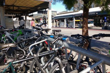
East-West Downtown Route
There isn’t a single inch of asphalt dedicated to moving bikes between the east and west through San Rafael’s downtown. We need to fix that.
Each east-west street offers different challenges and will require creative thinking. We’d like to see:
- Improvements to the 4th St/2nd St./West End intersection to facilitate safe and convenient crossings for those travelling between downtown and West End
- An interim plan for bike lanes along 4th St. (protected, where feasible)
- A commitment to study the feasibility of fully protected bike lanes through downtown
Cross-Marin Bikeway
There’s no safe, convenient route for those traveling between West End and Cal Park Hill Tunnel. The route itself has been studied, but was not included in San Rafael’s last iteration of their Bicycle and Pedestrian Master Plan.
We’re calling for the City to include the projects identified in that study, which included:
- A multi-use path along the dangerous stretch of 2nd St. between West End Ave. and Miramar Ave.
- Minor treatments to form a low-stress connection through neighborhood side streets south of 2nd St.
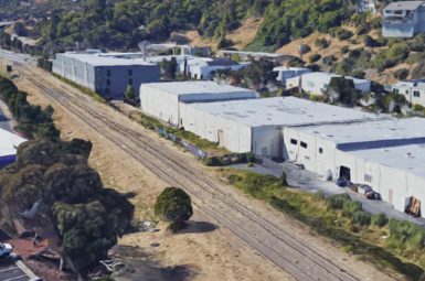
- A multi-use pathway near the San Rafael Community Center and Albert Park connecting B St. to Andersen Drive
- Better connectivity between Mahon Creek pathway and Andersen Drive
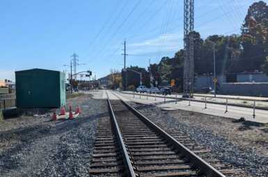
North-South Greenway
The stretches of Tamalpais Ave. and Hetherton St. between 2nd St. and Mission Ave. – which are responsible for connecting the North-South Greenway through downtown – will be subject to change as San Rafael’s Transit Center relocation gets underway. The low-stress experience of riding on the North-South Greenway should not be compromised by dangerous downtown streets. Key efforts include:
- Making the busy 2nd St./Tamalpais Ave. intersection easy to navigate for those traveling between downtown and the Mahon Creek or 2nd to Andersen pathways
- Identifying a low-stress route along Tamalpais Ave.
- Avoiding and eliminating conflicts with the high volumes of westbound right-turning vehicles off of Hetherton St.
Support Our Vision
Sign up for MCBC advocacy alerts on San Rafael’s Bicycle and Pedestrian Master Plan here.