Bike the Bridge | 11.16.19 Getting to/from the Richmond-San Rafael Pathway
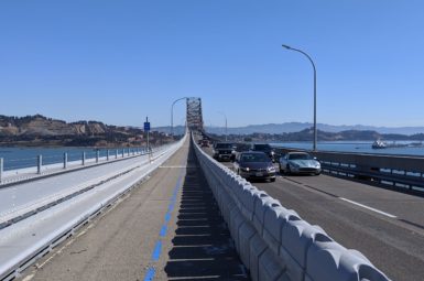
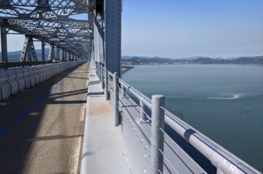
Bike the Bridge! After decades of advocacy from Marin County Bicycle Coalition, Bike East Bay, and SF Bay Trail, we’re delighted to announce that the Richmond-San Rafael Bridge multi-use pathway is now open! Head to our Richmond-San Rafael Bridge resource page for all things bridge-related, including route planning, news, and more!
If you’re wondering how to get to and from our new connection to the East Bay, you’ve come to the right place! Take a look at the map and turn-by-turn directions provided below for connections on the Marin side.
For East Bay connections and route planning, we recommend the following resources:
Project Map & Access Routes | Bike East Bay – Directions to/from Richmond BART | Bay Trail Map | East Bay Regional Parks District (EBRPD) Paved Regional Trails | EBRPD Mountain Bike Trails | Grizzly Peak Cyclists Routes
map: Marin connections
This map is interactive; you can zoom in and click on the features for more information.
turn-by-turn directions
eastbound From San Rafael
1. Take Francisco Blvd. W southbound to the new multi-use pathway at Rice Drive. Continue straight onto the pathway where the road veers right.
2. Take the pathway to Andersen Dr., then cross at the signal and continue eastbound.
3. Continue on Andersen Dr. to the intersection of Sir Francis Drake Blvd.
4. Turn left onto the two-way protected bikeway toward Francisco Blvd. E.
5. Turn right on Francisco Blvd. E and continue onto the R-SR Bridge Pathway.
eastbound from larkspur via cal park hill tunnel
1. Head north over the Central Marin Ferry Connector Bridge (white bicycle/pedestrian bridge) across Sir Francis Drake Blvd.
2. Continue through Cal Park Hill Tunnel toward San Rafael.
3. Take a right down the ramp onto Jacoby Street, then an immediate left onto Jacoby Street.
4. Take the next right onto Andersen Dr.
5. Continue on Andersen Dr. to the intersection of Sir Francis Drake Blvd.
6. Turn left onto the two-way protected bikeway toward Francisco Blvd. E.
7. Turn right on Francisco Blvd. E and continue onto the R-SR Bridge Pathway.
eastbound from larkspur VIA Sir francis drake blvd.
Caution: this route includes a busy, high-speed roadway.
1. Head east on the multi-use pathway that runs along the south side of Sir Francis Drake Blvd.
2. Continue on the shoulder of Sir Francis Drake Blvd.
3. Continue over the hill and onto the the I-580 on-ramp shoulder.
4. Take the San Quentin/Main St. exit.
5. Turn left onto Main St. and proceed under the freeway.
6. Turn right onto the R-SR Bridge Pathway.
westbound to larkspur / san rafael
1. Exit the bridge onto Francisco Blvd. E.
2. Continue down Francisco Blvd. E for about 1/2 mile.
3. [!] Just past Grange Ave., turn left onto a short connector path to the Sir Francis Drake Blvd./I-580 flyover (shown below).

TO SAN RAFAEL
4. From the Sir Francis Drake Blvd./I-580 flyover, turn right onto Andersen Dr.
5. Continue on Andersen Dr. to the intersection of Francisco Blvd. W. Take a right to access the pathway along the train tracks.
6. Exit the pathway at Rice Dr. and continue along Francisco Blvd. W toward Downtown.
to larkspur via cal park hill tunnel (Recommended)
4. From the Sir Francis Drake Blvd./I-580 flyover, turn right onto Andersen Dr.
5. Turn left onto Jacoby Street, then take a right up the ramp onto the pathway to Cal Park Hill Tunnel (shown below).

6. Continue south through Cal Park Hill Tunnel toward Larkspur.
TO LARKSPUR VIA sir francis Drake blvd.
Caution: this route includes a busy, high-speed roadway.
4. From the Sir Francis Drake Blvd./I-580 flyover, continue straight on Sir Francis Drake Blvd.
5. [!] Just past Drakes Cove Rd., turn left onto the pathway at Remillard Park (shown below).

6. Take the pathway west toward Larkspur Ferry Terminal.
members make it happen
All of our work to make bicycling in Marin safe, fun, and accessible relies on your generous giving. Please support your bicycle coalition by making a one-time or recurring gift today!


