Nighttime Trail Closure Pilot MCOSD Settles Audubon Access Lawsuit
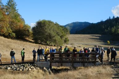
Marin County Parks and Open Space District have announced a settlement in the lawsuit filed by Marin Audubon related to the adoption of Contour Trail, Boulder Springs Trail and Candalero Trail in the Giacomini Open Space Preserve. The trails were designated in 2015, enhanced during 2017 and are now open to bikes and safe from litigation.
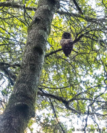 As part of this settlement between Marin Audubon and Marin County, Parks has agreed to implement a five year pilot program to address possible impacts to spotted owls that nest within trail corridors. During this period, ten trails across Marin will be closed to all users one hour after sunset from February 1 to July 31.
MCBC strongly supports reducing impacts to wildlife and could have easily worked together with conservation organizations to craft the same type of outcome. Choosing to arbitrate in court, rather than through meetings of stakeholders or the existing public process, denied MCBC an opportunity to provide our knowledge of wildlife and promote our environmental ethics.
Moving forward, we ask all Open Space visitors to help make this pilot program a success by complying with the nighttime closures* on the following trails:
- Boulder Springs Trail, Gary Giacomini Open Space Preserve
- Willis Evans Trail, Gary Giacomini Open Space Preserve
- Hunt Camp Trail, Gary Giacomini Open Space Preserve
- Haute Lagunitas Trail, Gary Giacomini Open Space Preserve
- Fairway Trail, Camino Alto Open Space Preserve
- Octopus Trail, Camino Alto Open Space Preserve
- Piedmont Trail, Baltimore Canyon Open Space Preserve**
- Warner Canyon Trail, Blithedale Summit Open Space Preserve**
- Porcupine Trail, White Hill Open Space Preserve
- Blue Ridge Fire Road, Cascade Canyon Open Space Preserve
*The closures are effective from February 1 – July 31 for five years (through 2022) one hour after sunset.
**Not open to bikes.
Data will be collected using Eco-Counters. The infrared devices operate much like a TV remote control. Sensors at different heights will detect a passer-by, whether it’s a hiker, a mountain biker, or an equestrian, and compile the data. The statistics are transferred remotely and integrated into software that helps analyze visitation trends. Visitation information will be shared with the public and the Board of Supervisors periodically.
The Eco-Counters, already in use within other recreational open spaces such as the Golden Gate National Recreation Area, collect data 24 hours a day, seven days a week. They do not take photo images and will not be used for trail-use enforcement purposes.
The resulting data will be help Open Space pursue intelligent trail proposals, which provide safe and inspiring trail experiences that have minimal impact on nearby wildlife and native vegetation.