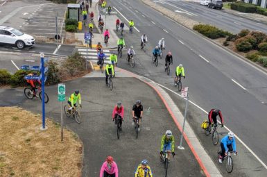
Road Advocacy Road Program Update – Summer 2021
Last month we posted Part 1 of the mid-year Road Program update. If you missed that, find it here. There are a lot of exciting things happening in Marin County. Below are the most impactful projects currently in the pipeline.
None of this important work would be possible without you: members of the Marin County Bicycle Coalition.
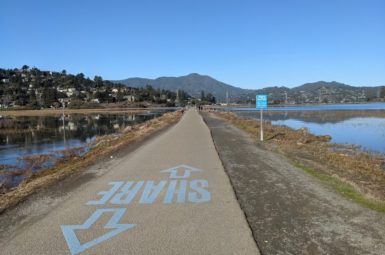
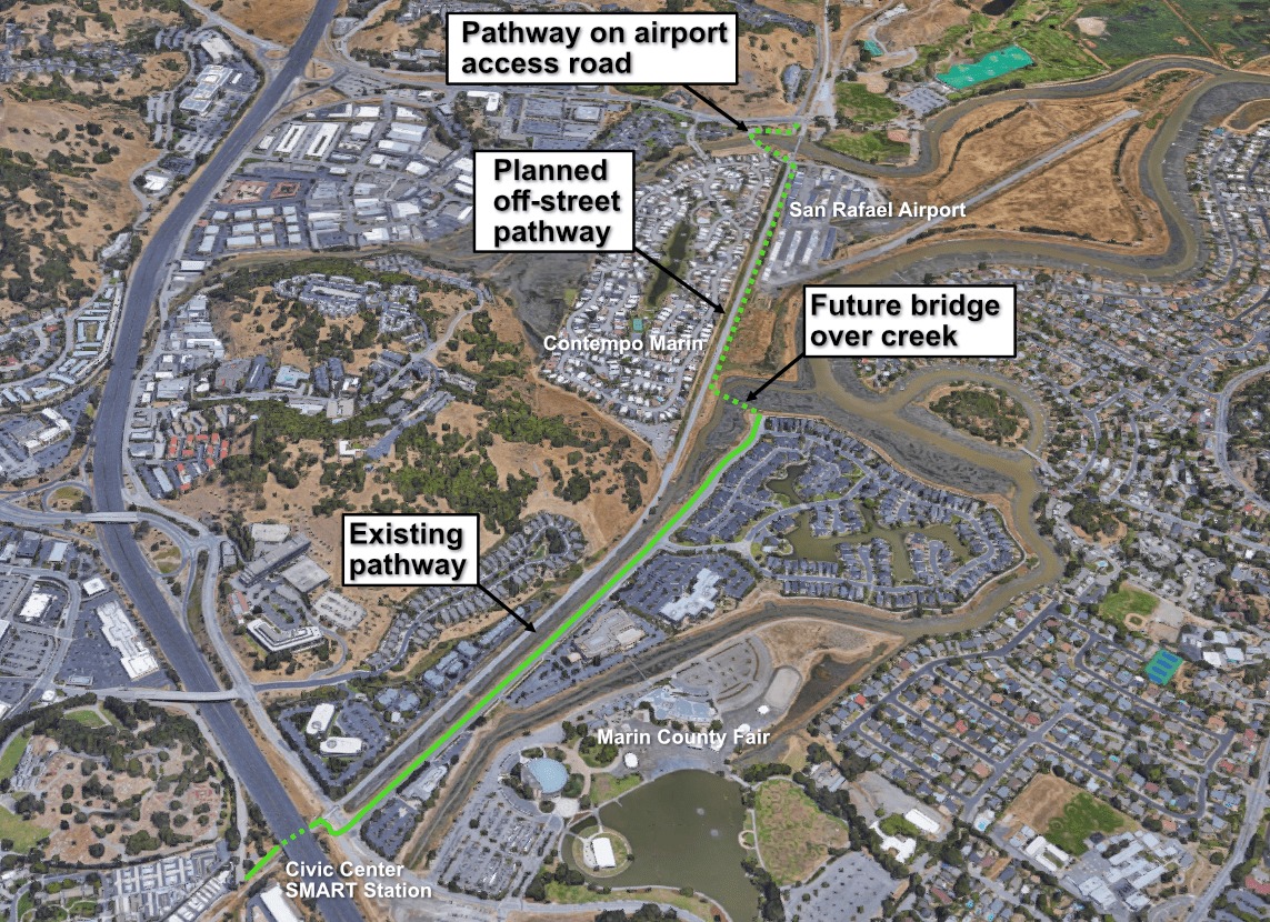
SMART Pathway – Civic Center to Las Gallinas
Location
Between the northern end of McInnis Parkway and Smith Ranch Road in San Rafael.
Description
This project will close a gap in the SMART pathway and the San Francisco Bay Trail over Gallinas Creek connecting the Civic Center Station, the Marin Civic Center, San Rafael Airport, McInnis Park, and premier birding opportunities at Las Gallinas Valley Sanitary District. The current bike route between Smith Ranch Road and the SMART Civic Center Station is 2.2 miles, passing through an interchange with US-101 and an uncomfortable ride along Redwood Highway. This project will cut that distance in half and provide a flat, off-street route.
This is yet another crucial gap closure getting us one step closer to the promised pathway between Larkspur and Cloverdale.
Status
This long-stalled project recently received construction funding from the Metropolitan Transportation Commission’s “Quick Strike” program.
Estimated Completion Date
SMART is currently completing the necessary paperwork to receive the federal funding, a sometimes arduous process. As reported this spring, SMART has been targeted with a lawsuit alleging that easement rights for the pathway were improperly obtained. Hopefully this lawsuit will be decided in a positive direction and will not impact construction of the pathway segment.
Vista Point Trail Gap Closure
Location
Golden Gate Bridge Marin Landing between the US-101 on ramp and Conzelman Road.
Description
Despite being the Bay Area’s most visible icon, and a world-famous tourist attraction, bicycle and pedestrian access to the Golden Gate Bridge is far from perfect. Traveling between the east and west sides of the bridge requires traversing a steep staircase or a half-mile detour on Alexander Avenue through two freeway off-ramps. Additionally, traveling by bicycle between Vista Point and Sausalito via Alexander Avenue is a high-stress route incompatible with the large numbers of tourists and inexperienced riders using the route.
This project would convert a currently-closed trail segment to a multi-use trail, creating a safer and more scenic route that is free of cars and providing an important trail connection for pedestrians and bicyclists from the north side of the Golden Gate Bridge to Fort Baker and Sausalito.
With this new trail, bicyclists and pedestrians would be able to travel to Fort Baker without mixing with cars; there they will find quiet bike lanes, sidewalks, restaurants, waterfront, and beautiful views.
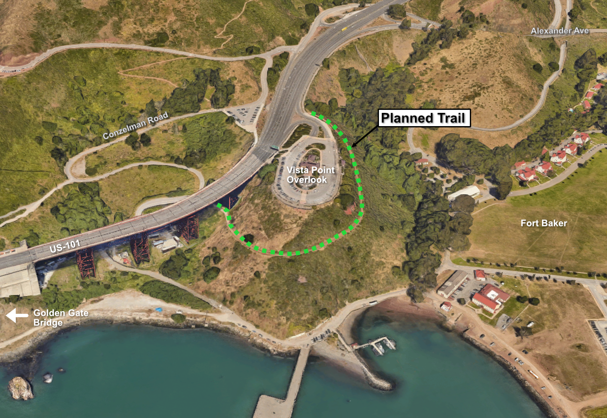
Status
Selected by US Representative Jared Huffman as a “member designated project” (the new term for congressional earmarks) to be included in the Surface Transportation Reauthorization Act currently being written and debated by Congress. While the bill has not yet passed, this project will likely be funded.
Estimated Completion Date
Unknown.
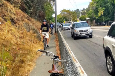
SMART San Rafael Connection
Location
Between Downtown San Rafael and Terra Linda from the top of Puerto Suello Hill (near the Lincoln Park & Ride) to the intersection of N San Pedro Road to Los Ranchitos Road.
Description
A separated multi-use path currently exists between downtown San Rafael and the top of Puerto Suello Hill. However, bike lanes on the Terra Linda side on Los Ranchitos and Merrydale are prohibitively steep for an ‘all ages and abilities’ facility, and there are no accessible sidewalks whatsoever, preventing easy pedestrian travel. Until recently, SMART considered this segment of pathway complete.
MCBC and Transportation Alternatives for Marin presented a gap closure alternative to the San Rafael Bicycle/Pedestrian Advisory Committee at their spring meeting.
The proposed project, the “San Rafael Connection,” would use a combination of Caltrans and SMART land to create a fully separated multi-use pathway running along the SMART tracks.
The presentation was well-received, and the members of the BPAC voted unanimously to send a resolution to the San Rafael City Council stating the San Rafael Connection was the preferred route for the SMART Pathway between Downtown San Rafael and Terra Linda.
We are pleased to report that at the urging of San Rafael Mayor Kate Colin, the SMART Board of Directors allocated $25,000 for a project feasibility study.
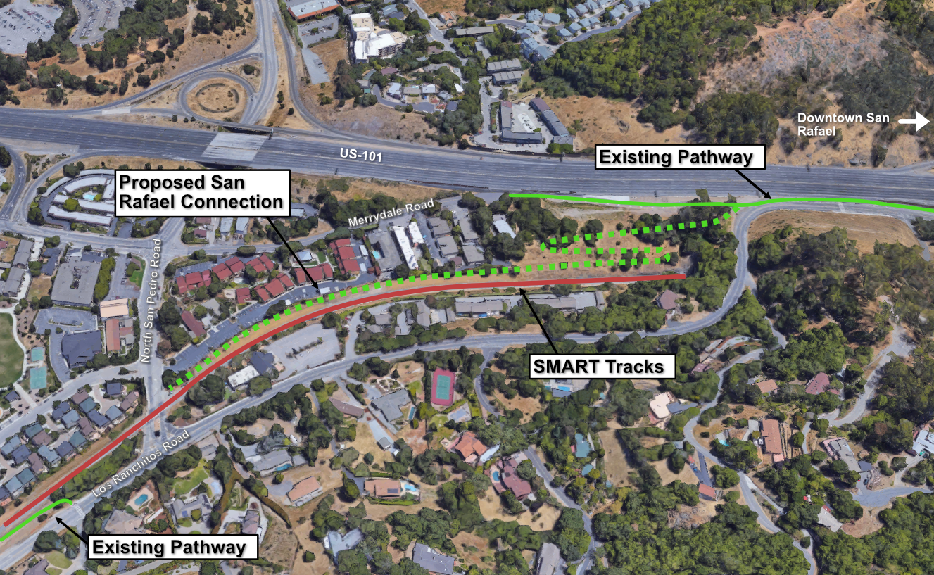
Status
The feasibility study, co-funded by San Rafael and SMART, is underway and will evaluate alignment options, opportunities and constraints, and provide a high-level cost estimate. Stay tuned for updates on this exciting development.
Estimated Completion Date
Unknown. Construction of the project will depend on the findings of the feasibility study.
Additional News
https://marinbike.org/news/pedestrian/big-wins-for-the-smart-path/
As always, if you want more information or would like to get involved in any of these projects, please email warren@www.marinbike.org.
sign-up for advocacy alerts
We will need your help winning these improvements! Please sign-up for advocacy alerts using the form below and we’ll tell you when/how to support our efforts.
members make it happen
We’re working to make Marin more bike-friendly for people of all ages and abilities. Are you with us?