MCBC Community Pantoll Weekend Bike-Packing Adventure
Our new Policy & Planning Director, Warren Wells shares his latest adventure by bike. If you’d like to share your story, adventures, or knowledge with the MCBC community, please email lynn@www.marinbike.org
A few times a year, I make sure to schedule a camping trip in Marin. With some of the most incredible natural beauty on the California coast just a few miles from where I live in the East Bay, how could I not? And because it’s all within a few miles of my apartment, I ride my bike instead of driving. That, and because I don’t own a car.
A few weekends ago my old roommate and I stayed at Pantoll Campground, in Mount Tamalpais State Park. It was a beautiful trip, sampling so much of the best roads, trails, and views that Marin County has to offer, and we did it all without driving. Here’s how we did it, and how you can too.
First, where to stay? There are so many different sites in Marin that all have their own character and feel. Want to wake up to towering redwoods wreathed in fog? Check out Samuel P. Taylor. Need to hit some single-track before breakfast? You definitely want China Camp. How about going to sleep to the sound of the surf and unbeatable views of the Golden Gate Bridge? Kirby Cove is your best bet.
For this trip, we picked Pantoll Campground because it has a hiker/biker campsite that you don’t need reservations for (first come, first served). All we needed to do was get there first and check in.
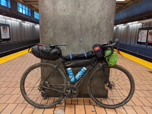
We were meeting a friend in San Francisco who wanted to join for just the ride, so we took BART in from the East Bay, hopping off at Embarcadero. After meeting at Marina and Fillmore, we continued across the Golden Gate Bridge. It was a clear, warm day without much wind and we made it across the bridge, through Sausalito, and up the Multi-Use Pathway in good time.

After stopping in Mill Valley for a quick coffee and bathroom break, we started up the Old Railroad Grade trail. You may not know this, but before you could drive up Mount Tam (before there were cars, actually) there was a train that ran from Downtown Mill Valley all the way up the mountain, which operated from the line’s completion in 1896 until 1929, when a fire in Blithedale Canyon destroyed much of the tracks. Trains started at the depot downtown (across the street from where we got our coffee) and turned up the Arroyo Corte Madera del Presidio stream, and up to today’s Blithedale Summit Trailhead, where the old rail alignment turns to a trail.
 Charles Weidner – http://www.alamedainfo.com/mt_tamalpais_Ca.htm
While there’s no longer any train service, because Old Railroad Grade was meant to be climbed by a train, it makes for an excellent biking trail. It’s a 5.3 mile climb (to West Point Inn) with about 5.6% elevation. It’s not easy while loaded for camping, but it’s totally doable if you’re not trying to sprint it (and would be a breeze on an e-bike). Every rest break gives you increasingly gorgeous views of the whole Bay Area, culminating with the West Point Inn.

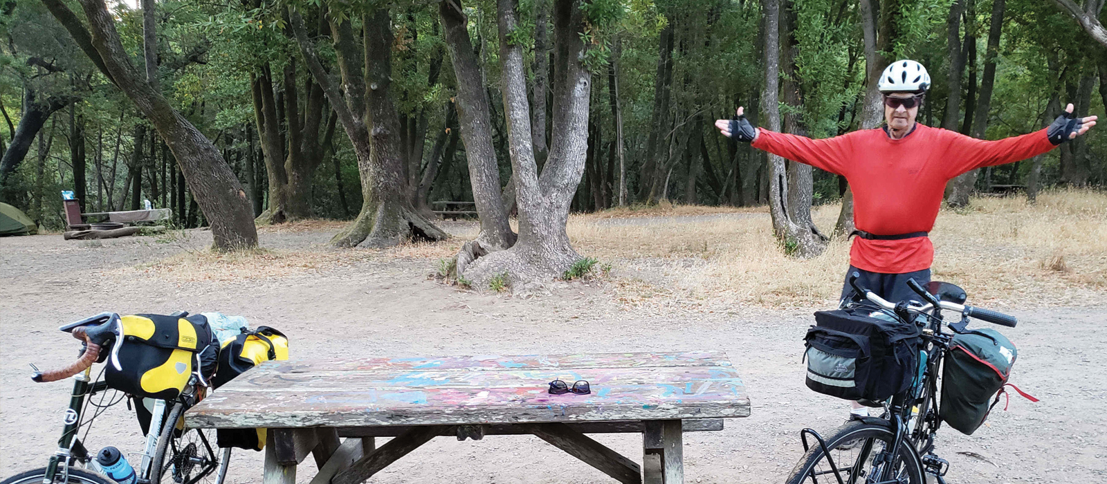
We wanted to get to the campground before someone else grabbed the spot, so we had a quick descent down Old Stage Road, which dumps out right at Pantoll Station, at the intersection of Panoramic Highway. Happily, the hiker/biker spot was still open, so we set up our tents, left our extra gear, and set out for Phase 2 of the ride, free from camping gear!
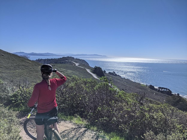
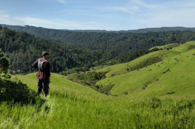
We started with a descent down the Coast View Trail, which has stunning views, although it’s fairly narrow and is a bit rough on a gravel bike. It also had a little more foot traffic than I feel good riding around. We finished the descent on Route 1, and decided it was time for lunch. We arrived at the Pelican just in time to beat the lunch rush. I was a little leery about loading up on fried fish and cider before another dirt climb, but it was definitely worth it.

We climbed out via Green Gulch, which is a relatively easy, well-shaded climb with one tough stretch near the top. My day-trip friend headed back to the city, as my roommate and I descended the Dias Ridge Trail. We finished with one last climb up the Deer Park Fire Road. Let’s just say I was very ready to be off the bike by the time we got back to camp and, after catching the sunset at Trojan Point, eating a big dinner, and taking a swig from my camping flask, we retired to our tents.

Day two saw us getting off to a leisurely start, rolling out around 10 AM. The great part about camping on a mountain is that your second day is all downhill! Or mostly, at least. We hauled ourselves up Pantoll Road to Ridgecrest Boulevard, turning east toward the peak (once the Easy Grade Trail is complete, we could have done this on dirt!). But rather than take Ridgecrest to the end, we dropped onto the Lagunitas-Rock Spring Fire Road, which is a straight shot all the way to Lake Lagunitas with some great views of the Mt. Tam Watershed. We took a quick lap of the lake before linking a few more trails on our way to Fairfax (Fish Grade, Shaver Grade, Deer Park Fire Road).

From there it’s a straight shot back to the East Bay, with just a few flat miles in between. Biking through San Rafael (with a quick, but delicious, stop at Sol Food) I got to survey some recently installed bike infrastructure: the two-way cycle track on Francisco Blvd W and 580 flyover connecting Andersen Dr to Francisco Blvd E. The views from the Richmond-San Rafael Bridge path were breathtaking as always, and we got a few impressed nods from bikers coming the other way, as they saw that we were riding loaded.

As we touched back down in the East Bay, we reflected on what a great trip it was. While there’s certainly a lot that still needs to be improved, we were able to do a whole weekend camping trip with just our legs, our bikes, and a bunch of snacks. Sure, it was harder than if we’d driven a car, but who goes camping because it’s easy? When you go camping by bike, the journey becomes a part of the destination. You know, that seems like a lesson for life there…
OK, OK, sappiness aside, thanks for reading! I’ll be doing some future stories on bike camping, packing tips, and in the post-covid future, I’ll be leading an intro to bike camping ride! Stay tuned and happy riding!
– Warren
P.S. For the Strava-inclined out there, or those who just want ideas, here are my routes from Day 1 and Day 2. Feel free to email with any questions!
All of the routes on Warren’s ride appear on the Marin County Bike Map!

Grab yours today from the MCBC Shop!
MEMBERS MAKE IT HAPPEN!
All of the great results you read about above are made possible by you, our members. Not a member? Join Marin County Bicycle Coalition today and enable an even better 2021!