Take Survey & Sign Up for Alerts Help Make San Rafael Safer for Walking and Biking
Wherever you live in Marin, odds are that you pass through San Rafael at least occasionally en route to work, school, shopping, or recreational destinations. Wouldn’t it be nice if you and your children could do this safely on a bike?
When the City of San Rafael last adopted a Bicycle and Pedestrian Master Plan in 2011, it did so without making room for bicycles in and around the downtown area. The City is now updating this plan, presenting a major opportunity to lay the foundation for the creation of a safe network of bikeways.
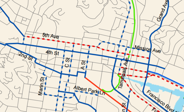
San Rafael’s 2o11 Bike Plan for the downtown area. Dashed lines represent proposed facilities, while solid lines represent existing routes. The only east-west crossings with bike lanes (red) were proposed along 5th St. and short segments of 2nd and 3rd St. near the freeway. Blue lines represent shared lanes.
Much has changed since 2011. Protected bike lanes are now a standard practice. Cities are designing connected networks of bikeways that appeal to people of all ages and abilities. The City of San Rafael is moving forward with a multi-use pathway linking downtown to the Cal Park Hill Tunnel (commonly referred to as the 2nd to Andersen multi-use path, or MUP), as well as a new bicycle and pedestrian bridge along Grand Avenue that will provide safer connectivity to and from the Canal Area.
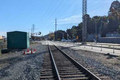
There’s also lots in flux. The transit center will need to be reconfigured and relocated–first temporarily, then permanently. With many of its 9000 daily users arriving and departing by foot and bike, people need safe ways to get to and from the station.
Here’s what you can do:
- Take the City of San Rafael’s survey and identify unsafe locations to help inform the plan update.
- Sign up for updates from MCBC to learn more about the plan update process and get involved with MCBC’s advocacy efforts.