Comments Needed by 11/19 Help Secure Downtown San Rafael Improvements
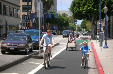
Protected bike lanes (like the one shown above in San Francisco) are among our priorities for the San Rafael Transit Center Project. Photo from Nick Falbo, Alta Planning + Design
The streets surrounding the San Rafael Transit Center form the most dangerous area to walk and bike in Marin County. Entire city blocks will be reconfigured as part of the upcoming Transit Center relocation project, but proposed plans are sorely lacking in needed bike improvements, including a long-planned North-South Greenway connection. Join MCBC today in telling project planners they must prioritize safety for people on foot and bike.
As we’ve written time and again, the area surrounding the San Rafael Transit Center is incredibly inhospitable. Between 2006-2016, over 160 people were hit–three killed–while walking or bicycling through the area, making it the most dangerous area to walk and bike in Marin County. As the North Bay’s busiest transportation hub and gateway to San Rafael, the area should welcome those travelling by foot and bike, rather than putting them in harm’s way.
That’s why MCBC is looking at the San Rafael Transit Center Project as a once-in-a-lifetime opportunity to reinvent this area. MCBC is calling on supporters to echo our priorities through the form embedded below (submissions will go to the project planners). Comments are due by Monday, November 19.
OUR PRIORITIES
-
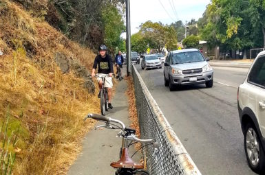
Include the North-South Greenway along Tamalpais Avenue between Mission Avenue and 2nd Street, connecting the Puerto Suello Hill Pathway with the soon-to-be-built 2nd to Andersen Pathway. Like the pathways the four block stretch will connect, the route should be free of hazards such as passenger loading zones, bus bays, on-street parking, and vehicular traffic.
-
Include protected bike lanes along 4th Street. There isn’t a single inch of asphalt dedicated to moving bikes east and west through San Rafael’s downtown. Any configuration that results in reconstruction of 4th Street frontage should include protected bike lanes.
-
Create a safe, convenient, and attractive pedestrian experience. People walking through the area should be free to take direct routes free of dangerous roadway crossings. Public spaces should be incorporated throughout the project.
-
Conveniently locate secure bike parking, bike share, and space for other emerging car-free mobility options (such as shared scooters) in order to improve connectivity to and from transit.
Tell the project team to include our priorities by submitting YOUR COMMENTS BELOW
Be specific about the improvements you’d like to see. These comments will go directly to the project team and inform their design considerations. Add a personal touch to your note: tell them how you currently travel through the area, what kind issues have you have experienced while walking or biking, etc.
To learn more about the project and view the current proposals, go to Golden Gate Bridge, Highway, and Transportation District’s project page.