news MCBC 3 Gaps Initiative
The Marin County Bicycle Coalition 3 Gaps Trail Initiative is focused on closing three of the biggest gaps in Marin’s trail network, which will create a car-free bicycle trail route from the Golden Gate Bridge to Point Reyes! To experience the full bounty of Marin’s parklands, bicyclists are currently forced to use narrow paved roads with no shoulders and fast moving vehicular traffic. The 3 Gap Initiative seeks to change that.
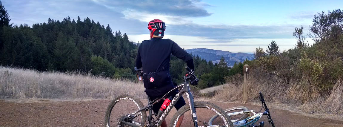
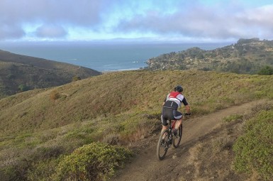
Many people choose off-road bicycling specifically to avoid motor vehicle traffic and the fear of being struck by a car. Consequently, most mountain bikers report a diminished experience when doing a ride of any real distance in Marin, due to the need to ride roads to connect trails. This is the reality for bicyclists that want to ride from GGNRA to Mt. Tamalpais State Park, and from Mt. Tamalpais State Park to the Marin Water District watershed.
Closing these three gaps would significantly enhance the outdoor experience for Marin’s bicyclists.
Benefits include:
- Improving safety for bicyclists by getting them off narrow roadways
- Reducing the number of bikes on narrow roadways, which can impede traffic
- Enhancements which reduce environmental impacts on two of the trails
- Spreads the work to expand opportunities for mountain biking fairly among Marin’s land managers
- Reducing illegal trail riding by providing bike legal connectivity
- Each proposal has multiple benefits including safety, connectivity and environmental enhancements
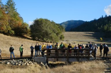
To move these projects forward, MCBC has worked with stakeholders and other interest groups to build support for each proposal. MCBC is partnering with land managers to find funding for these projects, recruiting volunteers to help build and maintain these facilities, and will provide educational outreach once they are complete.
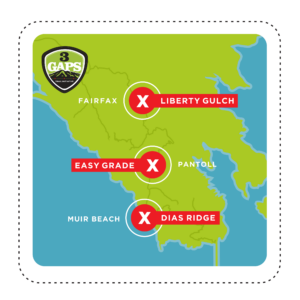
Gap #1 – Dias Ridge Phase II & III – GGNRA
Status: Phase II approved, slated for 2023 work season. No ETA on Phase III

Problem: Large user gap forcing bicyclists to use a 1.7 mile stretch of Highway 1, a narrow road between the Coast View Trail and Muir Beach.
Solution: Construct two new multi-use trails between the Golden Gate Dairy Stables and the Coast View Trail.

Benefits: Allows bicyclists an alternative to dangerous Highway 1, uses portion of existing ranch road, reduces the number of bikes traveling through the Muir Beach community and closes a multi-use gap in the Bay Area Ridge Trail.
Gap #2 – Easy Grade Trail – Mt Tamalpais State Park
Status: Approved, under consideration for Recreational Trails Program (RTP) funding
 Problem: Large gap forcing bicyclists to use a 1.7 mile stretch of Pantoll Road, a narrow road between Pantoll Station and Rock Springs Fire Road.
Solution: Easy Grade Trail change-in-use to hiker/biker, providing connectivity between southern and northern sides of Mt. Tamalpais.

Benefits: Provides bicyclists an alternative to a narrow and curvy section of Pantoll Road, takes advantage of an existing redundant trail, avoids displacement (hikers and equestrians use Old Mine Trail and hikers use Bootjack trail), provides a road-free route to the Mountain Play, reducing vehicle trips, closes a bicycle user gap in the Bay Area Ridge Trail.
Gap #3 – Liberty Gulch Trail on Azalea Hill – MMWD
Status: Phase I & II under construction, Phase III starts spring 2023
 Problem: Large gap forcing bicyclists to use a 1.3 mile stretch of Bolinas/Fairfax Road, a narrow road between Mt. Tamalpais and Pine Mountain.
Solution: a multi-use trail from Bull Frog Fire Road to Fairfax/Bolinas Road to create a car-free connection from Lagunitas and Bon Tempe Lakes to the Pine Mountain Fire Road.

Benefits: Allows bicyclists a car-free option to avoid a narrow section of Bolinas/Fairfax Road, recycles an historic stage road for multi-use, allows for improvements to that old road, which is currently inaccessible, removes a spaghetti of social trails on a steep, high value habitat, provides fast emergency response from Sky oaks to Pine Mountain.