MCBC Member Input Needed MCBC Priorities Reflected in San Rafael Plan Update
MCBC will lead a ride in San Rafael next Wednesday, May 23 to review priority projects included in the City’s Draft Bicycle and Pedestrian Master Plan, which is currently under public review. Click here for more information about the ride; read on to learn more about the Master Plan.
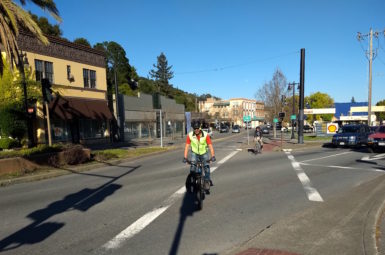
Downtown San Rafael is Marin’s busiest hub, with tens of thousands of trips made to and through the area on a daily basis. In spite of this, bicycle connections through Downtown remain almost non-existent, forcing people on bikes to share the roadway with fast-moving traffic. Thanks in large part to MCBC’s involvement, San Rafael is set to adopt a plan that lays the foundation for a safe, connected bike network comprised of pathways, protected bike lanes, and traffic-calmed bike boulevards.
San Rafael recently released its Draft Bicycle and Pedestrian Master Plan, a document that will guide implementation of walking and biking improvements on the roads we use. The last iteration of this plan – adopted in 2011 – did little to establish a vision for a safe, connected bike network. This lack of clear vision, combined with ongoing safety issues, is why MCBC has been so focused on the current plan update.
MCBC supporters have a few upcoming opportunities to give feedback on this Draft Master Plan before it goes to the City Council for adoption in mid-June. Time to comment is limited.
We are asking MCBC members and supporters to:
- Review the San Rafael Draft Master Plan
- Provide input – email Lauren Davini and/or attend a community meeting next Tuesday, May 22, 6 PM at Transportation Authority of Marin (900 Fifth Ave Ste. 100, San Rafael)
- The comment period will close Tuesday, May 29
- Final adoption of the plan will be considered at the Monday, June 18, 7 PM City Council meeting at City Hall (1400 Fifth Ave, San Rafael)
MCBC Priorities
From the outset of the planning process, our highest priority has been the creation of a safe, connected bike network through downtown San Rafael that works for people of all ages and abilities and connects to regional bike routes, including the North-South Greenway and Cross-Marin Bikeway. The map below shows our highest priority projects in the downtown area.
East-West Downtown Route
Why it Matters: There isn’t a single inch of asphalt dedicated to moving bikes between the east and west through San Rafael’s downtown.
MCBC Proposal:
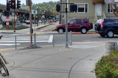
- Improvements to the 4th St/2nd St./West End intersection to facilitate safe and convenient crossings for those travelling between downtown and West End. (Included)
- An interim plan for bike lanes along 4th St. (protected, where feasible). (Omitted)
- A commitment to study the feasibility of (or pilot) protected bike lanes through downtown. (Included)
Cross-Marin Bikeway
Why it Matters: There’s no safe, convenient route for those traveling between West End and Cal Park Hill Tunnel. The route itself has been studied, but was not included in San Rafael’s last Bicycle and Pedestrian Master Plan.
MCBC Proposal:
- A multi-use path along the dangerous stretch of 2nd St. between West End Ave. and Miramar Ave. (Included)
- Minor treatments to form a low-stress connection through neighborhood side streets south of 2nd St. (Included)
- A multi-use pathway near the San Rafael Community Center and Albert Park connecting B St. to Andersen Drive. (Included)
- Better connectivity between Mahon Creek pathway and Andersen Drive. (Included)
North-South Greenway
Why it Matters: The stretches of Tamalpais Ave. and Hetherton St. between 2nd St. and Mission Ave. connect the North-South Greenway through downtown. The low-stress experience of riding on the North-South Greenway should not be compromised by this short on-street connection.
MCBC Proposal:
- Making the busy 2nd St./Tamalpais Ave. intersection easy to navigate for those traveling between downtown and the Mahon Creek or 2nd to Andersen pathways. (Omitted)
- Identifying a low-stress route along Tamalpais Ave. (Included)
Canal Connections
Why it Matters: The Canal neighborhood is incredibly isolated by water and freeways, with just two street connections to the rest of the City (via Francisco Blvd. West/Grand Ave. and Bellam Blvd.), both of which are dangerous and uninviting.
MCBC Proposal:
- Protected bike lanes on Grand Ave. connecting to the proposed east-west route on 4th St. (Included)
- Protected bike lanes on Bellam Blvd. connecting to the North-South Greenway. (Included)
- A commitment to study the feasibility of a more direct Canal crossing in order to keep those travelling between the Canal and Downtown/Montecito area from having to use Francisco Blvd. West. (Included)
MCBC supporters will have an opportunity to learn more about our advocacy efforts on these projects and more at next week’s Advocacy Ride.
Next Steps
As noted above, the City will take comments on the Draft Master Plan until May 29. MCBC will continue to review the plan and coordinate with advocates and partner organizations; we may call on your support for specific projects if needed. Regardless, we encourage you to review the plan to see if it addresses your concerns.
Questions or comments? Use the form below to connect with MCBC Policy & Planning Director, Bjorn Griepenburg –