Action Alert Feedback Needed for Region 5 Road and Trail System Designation
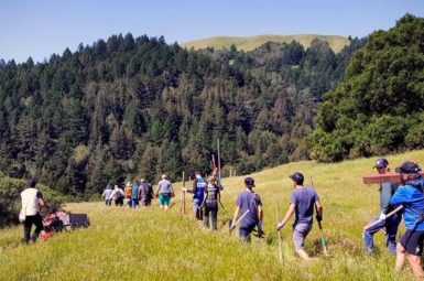
Following a public workshop held in late August, Marin County Open Space District has proposed adopting a number of trails as part of the Draft Road and Trail Designation for Region 5*, which will help close gaps along the Terra Linda/Sleepy Hollow Divide. At the public workshop, many people voiced support for a bike-legal trail between Santa Venetia and San Pedro Mountain.
We need your support to let land managers know how important this is to you. Please read the details below and use the form on this page to send an email to John Campo at the MCOSD to support this process.
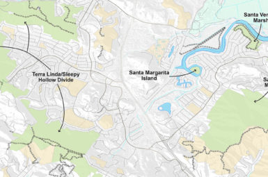
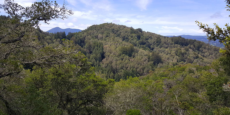
*MCOSD Region 5 includes Terra Linda/Sleepy Hollow, San Pedro Mountain, Santa Margarita Island, Santa Venetia Marsh, and Bald Hill Open Space Preserves, as shown on the map below.
ACTION NEEDED:
Take 5 minutes to craft a message to Open Space supporting better connectivity between North San Rafael (Terra Linda, Marinwood and Santa Venetia) and the Ross Valley (San Anselmo/Sleepy Hollow). Below is a list of the proposed trail adoptions and map. Please review the information and craft a personal message about your preferences in these Open Space Preserves, or simply cut and paste the truncated version below.
Dear Mr. Campo,
I have reviewed the Draft Region 5 Road and Trail System Designation and support all of the proposed trail adoptions, including segments 29520, 29510, 29275, 29110, 29326 and 29372. Additionally, I request that you adopt segment 32200 to provide options for connectivity between Santa Venetia and San Pedro Mountain.
Thank you for your consideration.
Use this form to submit your comments directly to the Marin County Open Space –
[The Region 5 comment period has closed]
Marin County Open Space District Region 5
This map that shows the general location of the trails, with more detailed information on each segment below.
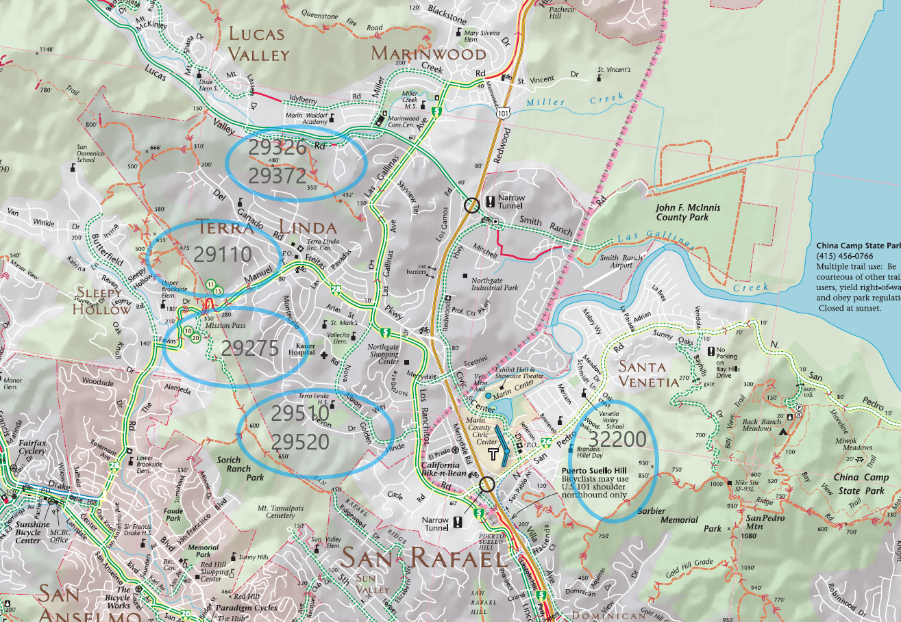
Ridgewood Fire Road to Dias Way and Ridgewood Fire Road to Malone Lane
Segment #29510 and Segment #29520
The adoption of these two social trails would provide an opportunity to create a multi-use trail to connect Ridgewood Fire Road with the Terra Linda High School and surrounding neighborhoods. It would create better connectivity between San Anselmo and the Civic Center and Santa Venetia neighborhood as well. Therefore we support adoption of segments 29510 and 29520.
Fox Lane to Mission Pass
Segment #29275
The adoption of this trail would provide an opportunity to connect Fox Lane with the Mission Pass pathway, Terra Linda Ridge Fire Road and the 680 Trail. Currently bicyclists have to drop down to Fawn Drive and then climb back up the road to make this connection, while hikers and equestrians enjoy through access on an existing system trail. Adoption of the parallel social trail would provide connectivity for all trail uses along this popular route. Therefore we support adoption of segment 29275.
Terra Linda Ridge Fire Road to Pecan Road
Segment #29110
The adoption of this trail would provide an opportunity to create a multi-use trail to connect Terra Linda Ridge with the Santa Margarita neighborhood, Freitas Parkway and Del Ganado Road. Therefore we support adoption of segments 29110.
Cherry Hill Fire Road to Springs Hill Fire Road and
Springs Hill Fire Road to Patricia Fire Road
Segment #29372 and Segment #29326
The adoption of these two social trails would provide an opportunity to create a multi-use trail to connect Cherry Hill Fire Road with Spring Hill and Patricia Fire Roads for improved connectivity between Marinwood and Terra Linda neighborhoods. Therefore we support adoption of segments 2972 and 29326.
San Pedro Mountain to Wood Oaks Drive
Segment #32200
This segment is NOT proposed for adoption, but MCBC recommends inclusion. In the Draft plan this social trail is slated for decommission. While the current trail has issues, including the fact that it ends on private property, it could be used to separate users or, coupled with Wood Oak Trail, provide a downhill companion to a Wood Oak Trail designated as an uphill only bike trail. Therefore we are asking Open Space to adopt #32200 as a biker/hiker trail so bicyclists have options for future connectivity between Santa Venetia with San Pedro Mountain.
CLICK HERE for the original workshop announcement flyer.
RTMP BACKGROUND
In December 2014, the Marin County Board of Supervisors unanimously approved adoption of the Road and Trail Management Plan (RTMP). The Marin County Bicycle Coalition contributed to the development of the RTMP, which promises to expand trail opportunities across 16,000 acres of Marin County Open Space preserves.
The plan provides a number of trail management options to increase mountain bike access, including priority-use, multi-use, time-separation (alternate-day), trail conversions, change-in-use and new trail construction. Before these actions can be taken, each Open Space Preserve has to go through an Initial Road and Trail Designation process to establish a baseline designated trail system that will evolve over time. To achieve this, Marin County Parks has divided 34 Open Space Preserves into six regions. To date, four of the six regions have completed the destination process, allowing both Open Space and the public to propose changes to the road and trails in those preserves.