News Richmond-San Rafael Bridge Multi-Use Path in Jeopardy
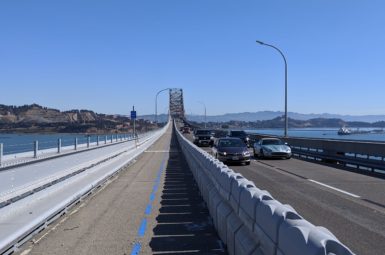
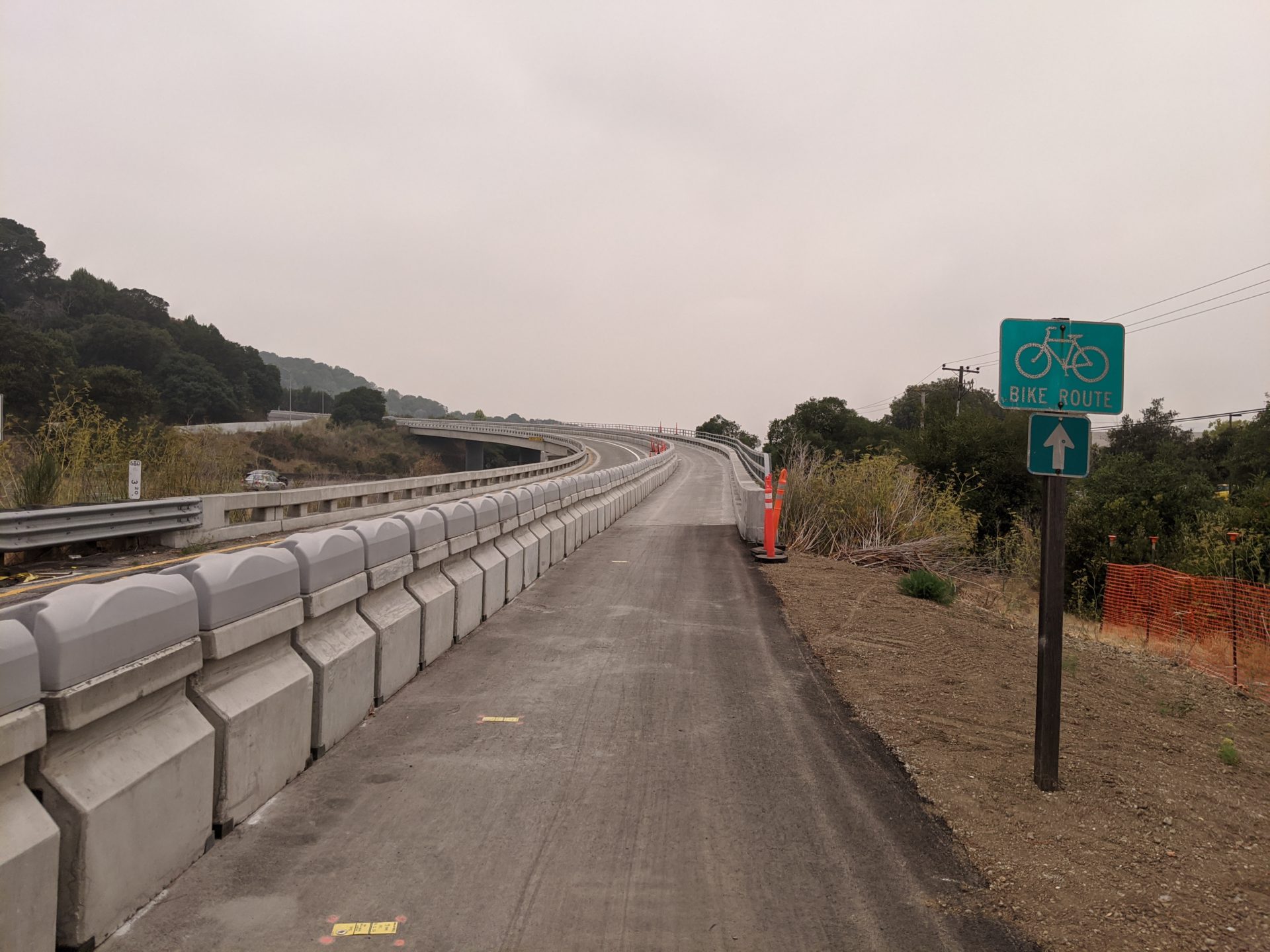
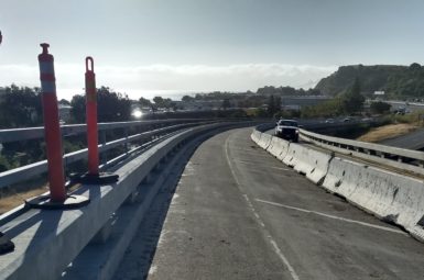
On November 16th, 2019, a multi-use pathway was opened on the Richmond-San Rafael Bridge, marking the first time in the structure’s 65-year history that people were able to legally cross the bridge by foot or bicycle.
Since that date, over 160,000 people have crossed it by bike, making it the 2nd busiest bridge crossing in the Bay Area. However, important though the connection may be, the pathway is technically part of a four-year pilot program, during which the use is being evaluated.
On Thursday, September 23rd, the Transportation Authority of Marin (TAM) will be hearing the results of a study to convert the pathway into a third car lane on weekdays between 5 AM and 11 AM. After reviewing the study, we find that it falls short in a number of regards.
The Study’s Findings
The study evaluates the costs and benefits of constructing a third westbound lane. There are two alternatives: Alternative 1 would widen the bridge and the landing near San Quentin (at a cost of $70-90 million) and Alternative 2 would include everything in Alt. 1 plus a direct, freeway-to-freeway ramp between US-101 westbound to I-580 southbound (costing an additional $220 million).
Alternative 1 is estimated to decrease rush hour travel time for westbound drivers headed toward San Rafael and point north by 11 minutes and increase travel time of those headed toward Larkspur and points south by 3 minutes. Shorter travel times for drivers going to US-101 South would only be realized with the additional quarter-billion dollar completion of Alternative 2.
The Study’s Failings
MCBC feels that the study falls short in several regards.
Alternatives
The two alternatives might be characterized as (A) widen and (B) widen some more. While both alternatives assume that Richmond-San Rafael Forward will be implemented (which includes cashless tolling and some other minor changes), no other policies are considered that might actually reduce congestion or increase person-throughput, such as congestion tolling (allowing tolls to respond to increased demand, such as on I-66 outside Washington, DC) or increased transit service. This is a major oversight. There are solutions to congestion besides widening roads, but TAM has not asked to see them evaluated.
Induced Congestion
The presentation frames the tradeoffs as being between direct financial costs (i.e. dollars) and the time benefits of car commuters. However, there are other costs of widening roads, namely inducing people to drive more. Decades of transportation research have shown that when you widen roads more people drive on them. LA Metro famously spent five years and over a billion dollars to widen the I-405 freeway, only to see congestion return worse than before mere months later.
Emissions
Even if the promised congestion relief arrives and persists (something that we have reason to doubt), increased auto capacity will mean increased greenhouse gas emissions, something the study does not mention. The state of California has goals to reduce GHG emissions and total vehicle travel (referred to as “vehicle miles traveled,” or VMT). This project would run counter to both. At best it is a congestion mitigation project, but it is far from a climate project.
What You Can Do
Click this link to send an email commenting on this item at the TAM Board meeting (this link was for a meeting on September 23rd. Please address further correspondence to TAM using this link or by emailing TAM’s Commissioners using their emails below). You can either use my talking points or write your own. For reference, our full letter to the TAM Board, co-signed by Bike East Bay and the Trails for Richmond Action Committee can be found here. While no decision is being made this week, it is important that the TAM Board hear that there is support for the pathway and that widening freeways without exhausting all other alternatives is irresponsible and unnecessary.
You can also attend the meeting, via zoom, starting at 6 PM on Thursday, September 23rd using this Zoom link. The item should come up around 6:30 PM.
Additionally, all five County Supervisors and some city/town council members sit on the TAM Board as well. A personalized email to them sharing your position would go a long way.
District 1: Damon Connolly – DConnolly@marincounty.org
District 2: Katie Rice – KRice@marincounty.org
District 3: Stephanie Moulton-Peters – smoultonpeters@marincounty.org
District 4: Dennis Rodoni – DRodoni@marincounty.org
District 5: Judy Arnold – JArnold@marincounty.org
Belvedere: James Campbell – jcampbell@cityofbelvedere.org
Corte Madera: Charles Lee – clee@tcmmail.org
Larkspur: Dan Hillmer – dhillmer@cityoflarkspur.org
Fairfax: Chance Cutrano – ccutrano@townoffairfax.org
Novato: Eric Lucan – elucan@novato.org
Ross: P. Beach Kuhl – beachkuhl35@gmail.com
San Anselmo: Brian Colbert – bcolbert@townofsananselmo.org
San Rafeal: Kate Colin – Kate.Colin@cityofsanrafael.org
Sausalito: Susan Cleveland-Knowles – sclevelandknowles@sausalito.gov
Tiburon: Alice Fredericks – afredericks@townoftiburon.org
sign-up for advocacy alerts
We will need your help! Please sign-up for advocacy alerts using the form below and we’ll tell you when/how to support our efforts.
members make it happen
We’re working to make Marin more bike-friendly for people of all ages and abilities. Are you with us?