Our Work Protected Bikeway Linking to R-SR Bridge Nearing Completion
Bike the Bridge! After decades of advocacy from Marin County Bicycle Coalition, Bike East Bay, and SF Bay Trail, the Richmond-San Rafael Bridge multi-use pathway is open! Head to our Richmond-San Rafael Bridge resource page for all things bridge-related, including route planning, news, and more!
Construction of a two-way protected bikeway linking to the Richmond-San Rafael Bridge is expected to be complete by July 31!
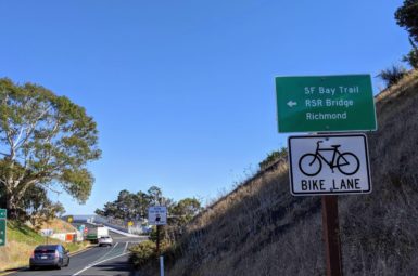
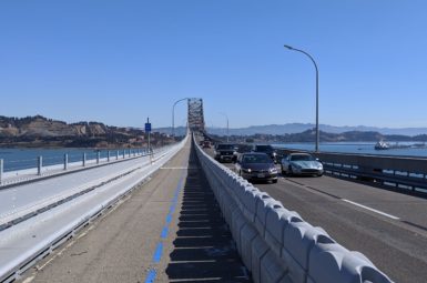
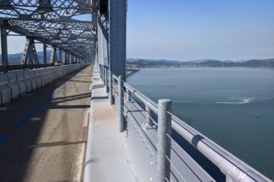
The new bikeway will link Francisco Blvd. E to Andersen Drive via the Sir Francis Drake off-ramp “flyover” structure, giving eastbound cyclists an alternative to riding on the I-580 on-ramp and shoulder to access the bridge. Cyclists will be able to use the bikeway–built in place of a former westbound only bike lane–in both directions due to it being physically protected by a moveable barrier identical to the one used on the Richmond-San Rafael Bridge.
The bikeway was MCBC’s highest priority project linking to the bridge due to the absence of a safe eastbound route. When complete, Andersen Drive (accessed via Cal Park Hill Tunnel for those coming from Larkspur) will be the recommended route for people riding to the bridge.
Last November, with backing from dozens of letters written by Marin County Bicycle Coalition supporters, the Transportation Authority of Marin (TAM) Board of Commissioners voted unanimously to provide $1.3m toward this bikeway, with an additional $800k coming from Bay Area Toll Authority (BATA). MCBC thanks our supporters, TAM Commissioners and staff, and BATA staff for moving this project forward in a timely manner.
Unfortunately, planned improvements along Francisco Blvd. E that will eventually complete a car-free connection between this new bikeway and the bridge itself are now unfunded due to a drop in bridge toll revenue during shelter in place. Agencies are currently seeking grant funding to deliver that project, which includes a .5 mi. multi-use pathway and improved access to the soon-to-be-complete bikeway at Grange Ave.
accessing the new bikeway
from andersen drive (Eastbound)
Upon reaching the intersection of Andersen Dr./Sir Francis Drake Blvd., take an immediate left; you do not need to cross traffic.
from the richmond-san rafael bridge (westbound)
Continue down Francisco Blvd. E for about 1/2 mile. Just past Grange Ave., turn left onto a short connector path to the Sir Francis Drake Blvd./I-580 flyover (shown below).

With additional improvements slated for Francisco Blvd. E now unfunded due to a drop in bridge toll revenue during the pandemic, MCBC is advocating for interim quick-build improvements that slow traffic and make it easier to spot this tricky left turn onto the flyover. For more on the remaining improvements, please read below.
completing safe routes to the r-sr bridge
Since the Richmond-San Rafael Bridge multi-use pathway opened late last year, we have been advocating for safer, more intuitive connections to and from the bridge. The following map highlights what we’re working on:
1) Green: A two-way, barrier-protected bikeway on Sir Francis Drake Blvd. between Andersen Dr. and Francisco Blvd. E. Status: Under construction.
2) Red: A multi-use pathway along Francisco Blvd. E. between Grange Ave. and the bridge. Status: Designed; delayed indefinitely due to decline in bridge toll revenue.
3) Blue: A multi-use pathway along Sir Francis Drake Blvd. between Remillard Park in Larkspur and Andersen Dr. Status: Last studied in 2011; advocacy needed.
To open this map in a new tab, click here.
improvements to francisco blvd. e delayed indefinitely due to drop in bridge toll revenue

Completion of a multi-use pathway along Francisco Blvd. E (shown above) is delayed indefinitely due to a sharp decline in bridge toll revenue during the Shelter in Place Order.
The Bay Area Toll Authority’s (BATA) construction of a multi-use pathway along Francisco Blvd. E (shown above and on the map in red) between the bridge and Grange Ave.–where it would connect with the protected bikeway described above–is now delayed indefinitely due to a sharp decline in bridge toll revenue during the Shelter in Place Order. The $5m pathway was originally slated for construction this year.
MCBC has reached out to BATA and TAM about addressing the funding shortfall; both agencies are currently seeking alternate funding sources.
Our push for interim improvements

BATA’s delayed project includes improved access to the protected bikeway on the westbound Sir Francis Drake off-ramp. This interim quick-build improvement would make the existing connection much easier to spot and safer for westbound cyclists.
Upon learning that the Francisco improvements were delayed, MCBC reached out to the City of San Rafael about installing interim “quick build” improvements that ensure safe, intuitive rides to and from the bridge while we wait on funding for BATA’s multi-use pathway. We have emphasized the need for dedicated, protected space for people on bikes, as well as a protected left turn pocket like the one shown above (rendering by MCBC) that would enable people riding westbound to access the protected bikeway leading to Andersen Dr. Discussions with City of San Rafael, Metropolitan Transportation Commission, and BATA staff have been encouraging.
UP NEXT: CLOSING tHE BAY TRAIL GAP

The Bay Trail currently ends at Remillard Park in Larkspur, leaving a .7 mile gap to the soon-to-be-built bikeway at Andersen Dr./SFD Blvd.
The County of Marin completed a study in 2011 analyzing bicycle and pedestrian connectivity in the San Quentin area, which included conceptual designs and cost estimates for completion of the Bay Trail between its existing terminus at Remillard Park in Larkspur and the Richmond-San Rafael Bridge. With the two projects above in progress, we are honing in on the final Bay Trail gap in this area, which would run along the southern edge of Sir Francis Drake Boulevard between Remillard Park and the Andersen Drive intersection. We are preparing a letter to several agencies and elected officials asking them to update the cost estimates from that study and prioritize this segment; we will alert you when we need your voice to move this project forward.
Sign-up for Advocacy alerts
If you would like to get involved in our efforts to win better routes to and from the bridge, please share your information below.
members make it happen
All of our work to make bicycling in Marin safe, fun, and accessible relies on your generous giving. Please support your bicycle coalition by making a one-time or recurring gift today!


