Reimagine Mt. Tam Watershed Recreation Plan Azalea Hill Site Visit and Update
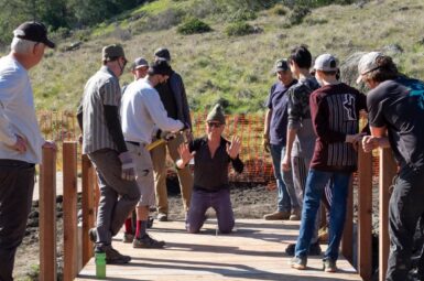
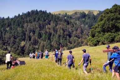
Turn out was strong for last Wednesday’s Watershed Recreation Plan activity – a site visit of the Azalea Hill Trail project on Mt Tam. The MMWD trail crew is currently working on Phase II of the project. It extends over a mile from the new bridge at Bull Frog Fire Road to where the old Liberty Gulch road starts to ascend from Alpine Lake. When complete the project will provide multi-use connectivity between the lakes area of Mt. Tam and Pine Mountain. It is part of our 3 Gaps initiative and MCBC has spent a decade bringing stakeholders together, helping develop the plan and finding resources to implement it. So it was no surprise that MCBC had an opportunity to speak at the site visit.
BACKGROUND AND HISTORY OF AZALEA HILL Project
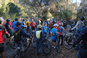 Off-Road Director Tom Boss talked about the initial meeting on top of Azalea Hill in 2011 with representatives from Marin Conservation League, Marin Horse Council and Tamalpais Conservation Club to discuss the possibility of including bikes in a project to address a number of recreation related issues on Azalea Hill. While there was openness to our desire to create a safer route to Pine Mountain for people on bikes (currently you have to ride around the Meadow Club golf course and up a mile of narrow winding roadway), there were concerns about the environmental impacts that widening the existing hiking trail would have on the steep terrain. The conversation continued and in 2015 consensus built around the adoption of the old Liberty Gulch ranch road as a multi-use connector trail on the West side of Azalea Hill.
Azalea Hill has phenomenal views of Mt. Tamalpais, Alpine Lake and Bon Tempe Lake, and is in fairly pristine condition, supporting all kinds of rare and native plants. There’s also an abundance of the bluish Serpentinite (California’s state rock) on the hillside. Serpentine barrens are characterized by open, rocky soil and support mostly scattered annuals such as jewel flowers, rosinweed (Calycadenia multiglandulosa), navarretias, and a few perennial plants such as lomatiums, and buckwheats. Many rare and locally rare plants may also be found within these areas. Click here for more information on serpentine barrens.
WATERSHED RECREATION PLAN AZALEA HILL SITE VISIT
Following the November 9th site visit, the planning process will take a break for the holidays and resume in February 2023. There will be three new bike-friendly MMWD Board Directors in January; Jed Smith (Division IV – Southern Marin): Matt Samson (Division I – San Rafael, Sleepy Hollow, Terra Linda) and Ranjiv Khush (Division III – Ross Valley, West Marin). See our Candidate’s Questionnaire page for their positions on mountain biking.
MCBC played a significant role in helping to secure a Recreation Trails Program (RTP) grant originally providing $700,000 for the Azalea Hill project. We also helped secure funds from the Hard Yaka Foundation for the construction of one of the bridges along the Liberty Gulch alignment. The bridge will carry a plaque recognizing MCBC and Hard Yaka for its funding contributions as well as volunteer support.
REIMAGINE MT. TAM
Sign-up for our Reimagine Mt. Tam Local Team to receive information on future Watershed Recreation Plan meetings and how you can help Reimagine Mt. Tam!
NOTE: Liberty Gulch Trail is currently closed to the public for ongoing construction. The lower portion may be open as an out and back sometime next year. The entire trail will not be open until a retaining wall at the top is completed in late 2023 or 2024.
members make it happen
All of our work to make Marin more bike-friendly is powered by your generous giving. Join the team fighting on your behalf for expanded trail access today!
