
The Marin County Board of Supervisors adopted the Unincorporated Area Bicycle and Pedestrian Master Plan (BPMP) Tuesday, February 27, signaling their support for a wish list including over $200m of unfunded improvements to Marin’s unincorporated areas, most notably including Alto Tunnel.
“We were pleased to see most of our requested revisions incorporated (in the Plan),” said Bjorn Griepenburg, MCBC’s Policy and Planning Director. “This plan lies at the heart of our work at MCBC – spanning from the vision of a completed network of safe, flat, and direct greenways that appeal to people of all ages and abilities, to short-term fixes on Marin’s popular recreational routes that minimize conflicts between people biking and driving.”
Bicycle and Pedestrian Master Plan Highlights
The BPMP has something for everyone, whether you prefer separated pathways and low-stress routes, or the challenges of Marin’s celebrated rural roads. While each of the projects is subject to additional vetting – including public outreach, environmental review, and funding – inclusion in the BPMP is an important step in demonstrating support for the projects and providing elected officials, advocates, and staff with a high-level view of unfunded needs and priorities.
Reinforcing a Long-Term Vision of Primary Bike Routes
Alto Tunnel lies just beyond the current terminus of the Mill Valley-Sausalito Pathway, which is part of the North-South Greenway and former Northwest Pacific Railroad alignment.
The BPMP highlights the importance of Marin’s primary bike network, the completion of which will be key in enabling the County to reach its proclaimed goals of making “the bicycle an integral part of daily life,” and “making bicycling safer and more convenient for people of all ages and abilities” – the latter of which was added at MCBC’s request.
The BPMP acknowledges Alto Tunnel’s importance, calling it out as the “only level route available between Corte Madera and Mill Valley” and “a crucial link to encourage walking and bicycling by all ages and abilities.”
“As other segments of the North-South Greenway are completed, this segment stands out as a major gap,” it continues.
The primary network includes the following:
- North-South Greenway: Follows the former Northwestern Pacific Railroad (NWPRR) and current SMART alignment from Sausalito through Sonoma County. Key gaps include Alto Tunnel and unbuilt segments of the SMART pathway.
- North-South Bikeway: Splits off from the North-South Greenway in Terra Linda and provides a north-south connection on the west side of US-101. This route is mostly complete and currently signed as Marin’s Route 5, though there are currently a few on-street gaps.
- East-West Bikeway: Generally follows the former NWPRR alignment from Pt. Reyes Station through Samuel P. Taylor State Park and San Geronimo Valley. Once the bikeway reaches San Anselmo, it splits into two; one segment continues easterly into San Rafael, while the other heads through Ross Valley along Corte Madera Creek. Although this route promises to be a challenging one to complete, there are a number of parallel roadways with little traffic.
- Bay Trail: The Bay Trail’s vision is for a 500-mile walking and bicycling path around the Bay’s shorelines, including those here in Marin County. Many segments have been completed, but large gaps remain, including SMART’s unbuilt pathway segments between the Civic Center and Hamilton Stations, as well as Highway 37.
Improved Rural Road Riding
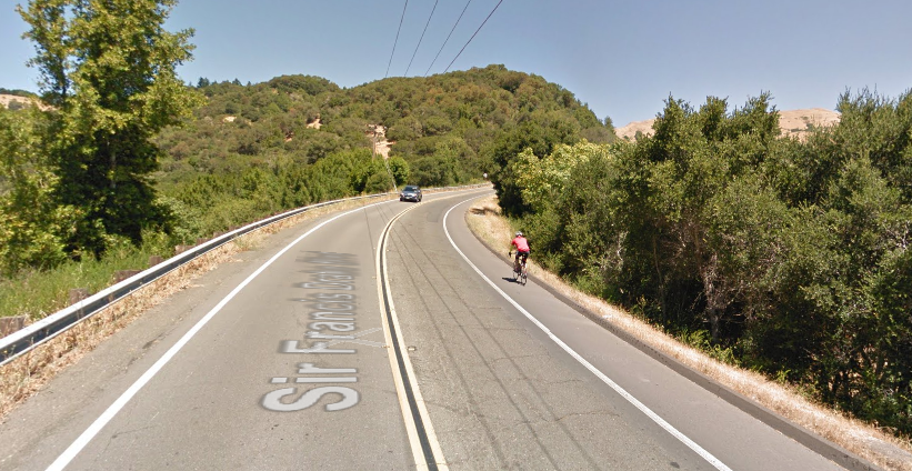
The White’s Hill westbound ‘climbing lane’ is a good example of the type of improvement identified for Marin’s most popular rural roads.
The County proposes a series of improvements to the more-heavily used rural roadways, including “Give 3 Feet” and “Bikes May Use Full Lane” signage, widening shoulders where feasible and appropriate (with emphasis on higher-speed segments and uphill grades), and improved maintenance, among other proposals. Ideally, these improvements would be implemented as part of routine repaving projects.
Designated roadways listed as good candidates for these treatments include the following:
- Highway 1: Tam Valley to Sonoma County
- Nicasio Valley Road: Sir Francis Drake Boulevard to Nicasio School
- Sir Francis Drake Boulevard: West of Lagunitas
- Paradise Drive
- Novato Boulevard: West of Stafford Lake
- Pt. Reyes-Petaluma Road: North of Nicasio Resevoir and between Platform Bridge Road and Highway 1
- Lucas Valley Road: West of Westgate Drive
- North San Pedro Road: East of Buck’s Landing
Other Highlights
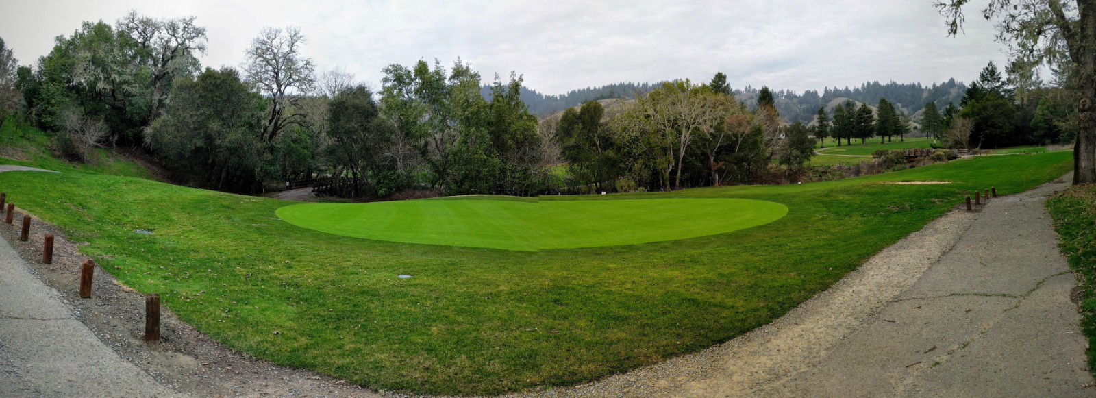
As the future of the San Geronimo Golf Course unfolds, former golf cart pathways may improve connectivity for San Geronimo Valley residents and visitors.
There are several other important projects we are excited about, including:
- Alexander Avenue and Vista Point Pathway: Implementation of several improvements that will facilitate safer access between Sausalito and the Golden Gate Bridge, including continuous bike lanes on Alexander Avenue and the long-promised Class I pathway from Vista Point to Fort Baker.
- Tam Valley Improvements: Study of long-term improvements, including an extension of the McGlashan pathway or installation of Class II bike lanes towards the Tennessee Valley trailhead.
- Mill Valley-Sausalito Path Rehabilitation: Incorporation of a “resilient, wider pathway” as part of a larger effort to mitigate or avoid the impacts of sea level rise and tidal flooding.
- Tiburon Boulevard Improvements: In addition to interchange improvements and the installation of a Class I pathway connecting Strawberry to Tiburon, the BPMP suggests considering Class IV protected bike lanes along the corridor instead of standard Class II lanes.
- Stafford Lake Pathway: A proposed pathway enabling people to bike from Novato Boulevard and Sutro Avenue to Stafford Lake without riding on the road.
- San Geronimo Golf Course: Consideration of a multi-use pathway system on the recently-acquired golf course enabling people to walk and bike through the area without having to travel along or across Sir Francis Drake Boulevard.
Advocacy from MCBC and others will be key in moving the various projects in the BPMP toward implementation. The BPMP acknowledges this, saying that “Its success will only be assured by the continued support of Marin County’s bicycling and walking community and other residents recognizing the benefits bicycling and walking bring to all residents.”
The County – which last updated this plan in 2008 – is the seventh agency to update its Bicycle and Pedestrian Master Plan since 2015, following Mill Valley, Tiburon, Corte Madera, Larkspur, San Anselmo, and Novato. Plan updates in Sausalito, Ross, and San Rafael are currently underway.
Keep up to date with bike-commuter and road projects in Marin –