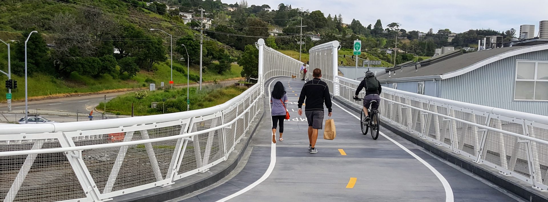
news East West Greenway in Marin
MCBC has continued to advocate for a comprehensive route linking our North-South Greenway to west Marin. The East-West Greenway, generally following the Northwestern Pacific Railroad right-of-way from San Quentin to Inverness – part of the visionary Marin Bicycle and Pedestrian Master Plan adopted by the county in May, 2001 – provides access to some of the legendary riding in west Marin.
Key developments and accomplishments have included the following:
- Widening of westbound Sir Francis Drake Blvd over White’s Hill – broader bike lane creates safer climbing
- Inkwells Bridge – Connecting 8 miles of pathways to the East-West Greenway
- Gallagher Ranch Acquisition – Connecting Tocoloma to Point Reyes Station in West Marin
- Giacomini Ranch – Efforts to restore the Giacomini Ranch to wetland and to provide public access
- Fairfax to San Rafael Cross Marin Bikeway Feasibility Study – A study to identify a feasible, safe and efficient east-west bikeway alignment from the western limit of the Town of Fairfax to Downtown San Rafael
Widening Westbound Sir Francis Drake Boulevard over White’s Hill
 Beginning in October, 2014, cyclists riding between Fairfax and the San Geronimo Valley experienced a safer ride! The Marin County Department of Public Works completed widening of a 3,300-foot stretch of westbound Sir Francis Drake Boulevard (SFDB) between Baywood Canyon Road, about 1 ½ miles northwest of downtown Fairfax, to the Hal Brown Bridge on White’s Hill.
MCBC worked closely with the County of Marin for many years on this project, resulting in five-foot wide shoulders for cyclists on SFDB. Historically, people riding bikes on this classic Marin route had to negotiate surfaces both dangerously narrow and significantly degraded.
MCBC met on-site with a group of traffic safety experts in June, 2012 to provide input on a traffic safety study prepared for the project and has continued to participate in the project’s development over the past two years to ensure improved safety for this important east-west connector. While safety improvements were completed only on the uphill climbing side of the roadway, there is now more room for automobile drivers to pass cyclists safely without crossing the center line. The result is a safer White’s Hill for all users in both directions. MCBC is very pleased about the significant safety improvement for cyclists and we extend our gratitude to the County of Marin for their leadership on this project.
The $237,000 Nonmotorized Transportation Pilot Program funded project included asphalt concrete road widening, installation of buttress walls, resurfacing of the previous road shoulder, and repainting of the fog line. “Sir Francis Drake over White’s Hill now is so much safer for the commuter and recreational bicyclist community, and for the motorists who share the road with them,” said District 2 Supervisor Katie Rice.
District 4 Supervisor Steve Kinsey, whose jurisdiction starts at the crest of White’s Hill, applauded the upgraded section as the East-West corridor gateway to West Marin. “The heavily-used shoulder has remained a safety challenge for decades, so its completion is the basis of both relief and celebration,” he said.
 Inkwells Bridge – Constructed in 2004
 Inkwells Bridge – Constructed in 2004
Connects to 8 Miles of the East-West Greenway
The Inkwells Bridge is located about 1/2 mile west of the town of Lagunitas, and was opened to use by bicyclists, pedestrians and equestrians in the fall of 2004. The bridge vastly improves safety by providing a connection for non-motorized travelers to get off a busy and narrow section of Sir Francis Drake Boulevard, and cross over Lagunitas Creek to a picturesque pathway that is part of the old Northwestern Pacific railroad right-of-way. The pathway runs for about 8 miles from Lagunitas through Samuel P. Taylor State Park to Tocaloma.
Gallagher Ranch
 The Gallagher Ranch, which lies within the boundaries of the Golden Gate National Recreation Area, contains redwood trees, crucial salmon habitat, and a former railroad right-of-way which could be converted to a multi-use trail for hikers, cyclists and equestrians.
  This trail would directly connect with eight miles of the existing Cross Marin Trail that runs through Samuel P. Taylor State Park, thus extending the trail network to 13 miles in length. This would provide a safe cycling alternative to Sir Francis Drake Boulevard and Point Reyes Petaluma Road, which are both narrow, winding roadways.
Beginning in the late 1980s to early 1990s, the National Park Service and the Gallagher family began conversations about the NPS’s purchase of the property- a proposal that is very strongly supported by MCBC, local cylcists and open space advocates, among others. Between 2001-2002, in an effort to build momentum and awareness around this effort, the MCBC hosted three bicycle rides on the Gallagher Ranch and the National Parks Service lands, allowing over 350 cyclists to experience the stunning beauty of this land.
Unfortunately, to date, a purchase agreement for the Gallagher Ranch by the NPS has yet to be reached. The conversion of the Gallagher Ranch to National Park Service lands would be an incredible asset to the Park Service, the community and visitors alike. The MCBC continues to seek out public and/or private collaborative opportunities to pursue the continuation of the Cross Marin Trail through the Gallagher Ranch property.

Giacomini Ranch
The 560-acre Waldo Giacomini Ranch property near Point Reyes Station was purchased for $5 million in 2000 by the National Park Service (NPS) for wetland restoration. MCBC – in partnership with the local Community Pathways Committee – is pursuing the establishment of a safe, non-motorized, multiuse pathway along the perimeter of the Giacomini Wetland Restoration Project.
 Construction of the restoration component of the Giacomini Wetland Restoration Project was implemented in two principal phases-Phase I in fall 2007 and Phase II in summer and fall 2008. The Project Restoration Map (1,560 KB PDF) shows all the restoration and public access components for both Phases.
Phase I, completed in December of 2007, principally involved removal of agricultural infrastructure and conditions and creation of special status species habitat. Phase II, the second and largest phase of the project, was completed in December of 2008. Phase II focused on marshplain and floodplain restoration; this included the realignment of Lagunitas Creek spur trail and the creation of a path to the Dairy Mesa viewing area.
Construction efforts aimed at restoring the former Waldo Giacomini Ranch to wetland were largely complete as of December 2008. However, this does not mean that restoration or construction is entirely complete.
Additional construction activities may occur in future years in the Giacomini Ranch and Olema Marsh should the National Park Service (NPS) and Point Reyes National Seashore Association (PRNSA) secure additional funding. These activities include the implementation of the public access portion of the project. In general, more monies are available for government agencies and non-governmental organizations for restoration than for public access.
Currently, there is a proposal by the National Park Service to install a bridge over a portion of Lagunitas Creek. This bridge would provide safe access to the pathway; a welcome change from walking or bicycling along portions of Sir Francis Drake parallel to the Giacomini Wetlands Restoration Project. MCBC supports this proposal, as we believe that it will serve local residents well. During a visit to the project area on a cold and windy day, MCBC staffers witnessed a large variety of visitors walking along the pathway, including older residents, children, and people out for routine exercise. Updated information pertaining to public access along the south end of the Giacomini Wetlands, such as the proposed bridge on Lagunitas Creek at White House Pool, can be found on the NPS’s project website here.
Fairfax to San Rafael Cross Marin Bikeway Feasibility Study
Fairfax San Rafael Study 2010 pdf download – 23 mb. A comprehensive study to identify a feasible, safe and efficient east-west bikeway alignment from the western limit of the Town of Fairfax to Downtown San Rafael.